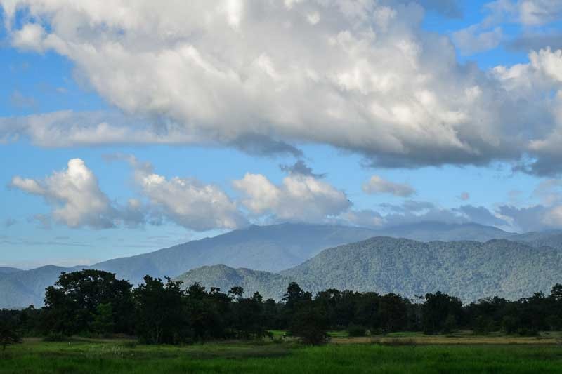
ORAL DISTRICT, Kompong Speu province – From the back seat of Kay Kin’s motorbike, the mountain loomed ever closer, as sugarcane fields lining the laterite road to its foot rushed past.
At 1,813 meters above sea level, the peak of Phnom Oral—Cambodia’s tallest mountain—towers over the surrounding forests, farms and sugarcane plantations.
“All of this belongs to Ly Yong Phat,” Mr. Kin, 33, said of the plantations as he muscled the vehicle along the increasingly rutted track toward the village of Sre Kin Thmey Bei—the end of the road and the home of our mountain guide.
According to Mr. Kin, a local rice farmer who agreed to drive us to the base of the mountain in November for a small fee, the ruling-party senator’s Phnom Penh Sugar company (and his wife’s Kampong Speu Sugar) first planted crops here in 2013, five years after they began clearing community forests inside their government-granted concessions.
The vast plantations have significantly altered the surrounding landscape, physically and economically.
“People now either work on the plantations or go deeper into the forest,” Mr. Kin said. “They preferred life before, because now their forests have gone.”
After fording streams, dodging water buffalo and edging closer to the mountain, we reached a section of the road traversable only by motorbike or tractor. The plantations ended and small subsistence farms took their place, with villagers growing rice and corn around their houses. At the road’s end, the village consisted of two small general stores, a pair of open-air restaurants and a primary school.
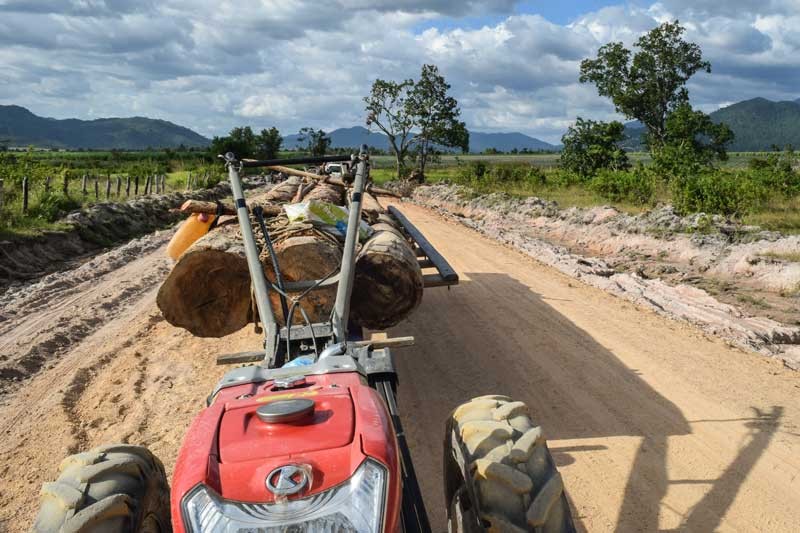
From here, innumerous tracks snake uphill into the Phnom Aural Wildlife Sanctuary, from which tractors loaded with timber return daily.
“I have now climbed the mountain 138 times,” said our guide, Chhoeun Chim, 34, as we set off from his house around noon after stocking up on food for the overnight trip.
“I keep a record, so I know how strong I am,” explained Mr. Chim, also a rice farmer and one of several part-time mountain guides in the village, as we waded across one of the many rainy-season streams that interrupts the maze of logging trails we were following.
Mr. Chim said he had noticed many changes to the mountain since he began guiding in 2002, most of them negative.
“I think about 30 percent of the forest has been cleared, especially in the lower areas,” he said during the two-hour walk to the mountain’s base.
When he started guiding, he said, the area was dense forest. Now, it’s spindly trees and grass, and even that is being cleared to prepare the land for cultivation.
Since first climbing Phnom Oral—also in 2002, “because I was curious”—Mr. Chim has taken tourists and researchers from around the world up and over the forested slopes.
With an elevation gain of about 1,650 meters, Phnom Oral doesn’t feature among the 100 tallest mountains in Southeast Asia, most of them in Burma and Indonesia, but the steep rise from the plains was especially testing in the heat.
To reach the peak, located on the far eastern edge of the Cardamom Mountains, most climbers take three days and two nights. Due to a tight schedule, we had only two half-days and a night to summit, descend and hopefully visit one of the mountain’s most mysterious attractions.
A stream separated the denuded landscape at the base of Phnom Oral from the verdant slopes above. The tractor tracks stopped, and were replaced by a single trail that led up to a small 1,000-meter peak before veering eastward along a ridge to the summit.
After the sunbaked approach, the trail was straightforward and bamboo groves provided welcome shade. Later, it followed a series of shallow steps hacked out of the muddy incline.
Further uphill, the whine of chainsaws was replaced by birdsong, the drone of insects, and the distinctive cry of elusive gibbons. Eventually, the fog and clouds that often blanket the mountain’s upper reaches muffled even these sounds, resulting in an eerie silence unimaginable in the chaos of Phnom Penh, just three hours away.
After climbing until dusk, the sight of our home for the night—a sturdy wooden hut in a clearing just two hours from the summit—was most welcome.
While we strung up our hammocks inside the hut, Mr. Chim set about cooking dinner over open fire. A pile of empty sardine tins next to the fire pit hinted at what was on offer, and indeed, rice with sardines and grilled pork comprised all three meals we ate on the mountain.
The night was surprisingly cold and windy, and the sweaters and blankets we had begrudgingly packed suddenly seemed less ridiculous.
After a breakfast of dinner, we continued our ascent at dawn, the visibility limited by thick clouds.
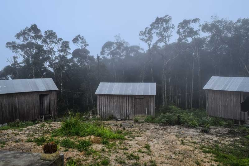
Two hours from our camp, the path led out out of the trees and into a large clearing: the summit. Three wooden huts stood on one side, a spartan temple and simple shrine in the middle—the most significant structures since Mr. Chim’s village.
Rather disappointingly, the highest point in Cambodia provided no view to speak of, and after a short break to take photos and snack on cold fried bananas, we began marching downhill in search of one of the mountain’s secrets.
Thirty minutes on, we left the main path and began bushwhacking toward where our guide thought it was.
Mr. Chim said he first came across the wreck when descending by himself on a particularly foggy day in 2012. “I was walking down from the top in heavy fog and got very lost, and then suddenly saw the plane,” he said.
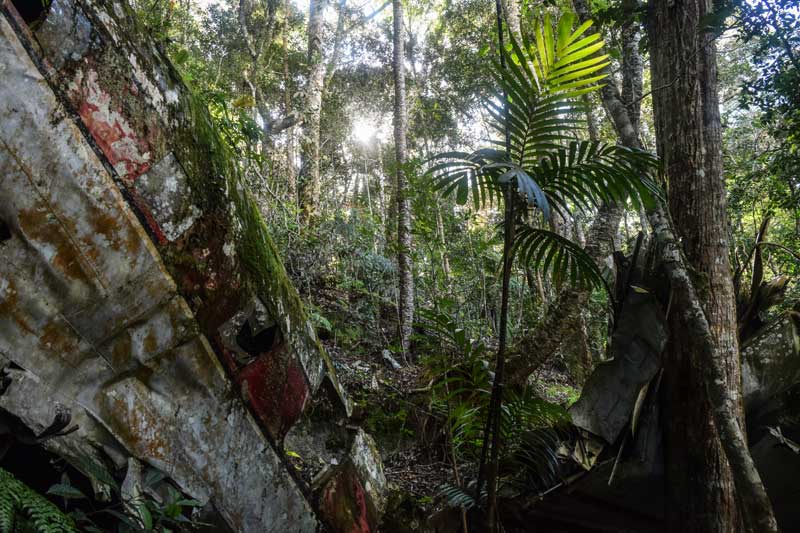
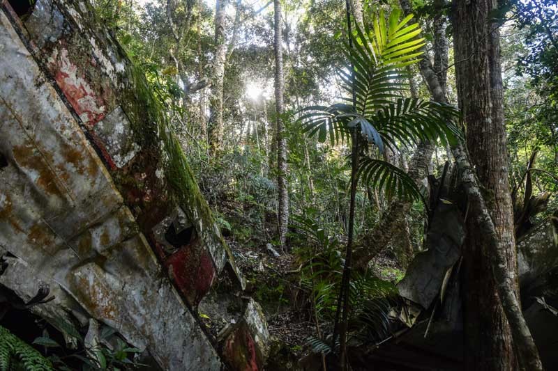
And just as suddenly, the twisted shards of moss-covered metal reared out of the forest before us: the remains of a Cambodian International Airlines (CAI) Curtiss C-46 Commando that crashed en route to Phnom Penh from Battambang City on Christmas Day in 1974, according to the Aviation Safety Network website.
The CAI logo and XW-PKJ registration number were visible on the tail section of the plane, which juts out from the slope at a 45-degree angle—the same angle at which the plane likely collided with the mountain 41 years ago.
The fuselage is broken into two parts, the cockpit having snapped off and fallen perpendicular to the tail and cabin, a large tree keeping it from sliding further down the slope.
The Aviation Safety Network website lists the two pilots as the only fatalities, but Mr. Chim, who explored the wreckage extensively when he first found it—both out of curiousity and in search of salable scrap—has never found any evidence of bodies.
He thinks the fog probably caused the crash, and with no signs that the plane was shot down, it seemed as good a theory as any. The wreckage is also the closest Mr. Chim has ever been to an aircraft.
“I have never flown and I am now scared of doing it—I don’t want my feet to be off the ground,” he said.
Speaking at her home in Oral district later that afternoon, Mr. Chim’s aunt, Suos Lan, said she remembered the crash well.
“I was collecting grass [near the base of the mountain] and heard an explosion at about 5 p.m.,” she said.
And while a plume of smoke marked the exact point of collision—which occurred during a period of constant fighting between the Khmer Rouge and Lon Nol government—“no one dared” to go and look, she said.
We reached the bottom of the mountain about four hours after leaving the summit, and with the heat increasing with every step, slip and stumble, the shade and sounds of nature were hard to leave behind. The relief of finally reaching flat ground (and respite to aching knees) was tempered by the realization that it would be slow return to civilization, and a bumpy motorbike ride.
Twenty minutes earlier, as we paused to refill our water bottles at a stream near the base of the mountain on the way, Mr. Chim spoke of his fears for the future of Phnom Oral.
“In three years, it will be logged up to here,” he said, gesturing toward the surrounding trees.
“In 10 years I think the road will bring more tourists to the mountain waterfalls,” he said. “But I don’t know if there will be any forest left by then.”

