

Google Maps is a tool many people utilise to identify places all over the world. The mapping service by Google has proved popular with those keen to identify what happened to the fated MH370 flight. Malaysia Airlines’ MH370 came down in 2014 after travelling from Kuala Lumpur, with an intended destination of Beijing. The tragedy left all passengers and crew presumed dead and what happened to the aircraft has remained a mystery.
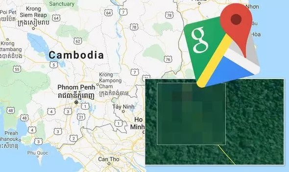
They have honed in on central Cambodia as a key area – and one geologist thinks he may have found the crash site.
Last year, geologist John Guo claimed he’d found the missing plane after a “crush path” in a stretch of trees in the Cambodian jungle was spotted on Google Maps.


