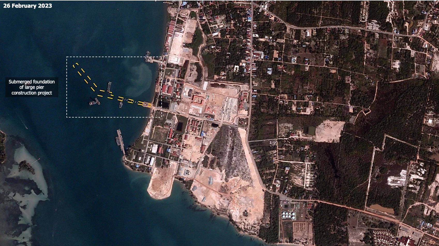
At DGI London on 27 February, BlackSky CEO Brian O’Toole stunned audiences with geospatial intelligence revealing the progression of China’s secret naval base in Ream, Cambodia. The quick response time satellite imagery that made this possible was as remarkable as the revelations that followed.
While the principle seems simple, only in the last three years has a company invested in the commercial application for intelligence, surveillance, and reconnaissance (ISR): instead of imaging satellites orbiting the world via the North and South poles, taking photographs across the whole earth once a day, BlackSky’s constellation of 14 satellites follow the equator, travelling in the opposite direction to the Earth’s spin. From this vantage point the satellites can capture images where human activity occurs, accounting for 95% of GDP production, and pass overhead every hour.
BlackSky’s constellation provides satellite imagery with analytics within 90 minutes of a user tasking the system. In the geospatial intelligence industry, the status quo ante had users waiting several days for a satellite image collection request to be completed.


