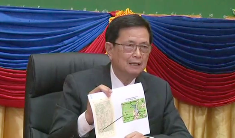
The head of the government’s border committee said Tuesday that villagers in Tbong Khmum province who are angry about Vietnam claiming 16.6 hectares of land they had farmed failed to inform authorities that they used the land before the countries signed a 2011 border agreement.
The plot of land along the border of Memot district became a flashpoint for political tension in April after a group of Vietnamese nationals, including three soldiers, sprayed poisonous chemicals on crops planted by Cambodian farmers.

Responding to a letter from CNRP lawmakers on behalf of the farmers, Foreign Affairs Minister Hor Namhong said that the land belonged to Vietnam. Mao Monyvann, a CNRP lawmaker representing Tbong Khmum, has since backed calls by nationalist activists for Mr. Namhong to step down over the dispute.
In a roundtable discussion organized by the Council of Ministers and posted to Youtube on Tuesday, Va Kimhong, chairman of Cambodia’s border affairs committee, said that the government would have attempted to keep the land if locals had informed them that they were farming there.
Mr. Kimhong said Cambodia successfully swapped another 100 hectares of land in the same area—in order to allow Cambodians to continue farming there—during negotiations that led to the signing of a 2011 memorandum of understanding with Vietnam.
“At that time, our sisters and brothers just claimed 100 hectares of land, that is why we advocated with the other party to keep 100 hectares of our farmland for our people,” Mr. Kimhong said.
“If they informed us about the other 16.6 hectares of land, we would have helped them through the 2011 MoU by swapping land of the same size,” he added.
Mr. Kimhong noted that since the 1950s, border talks between Cambodia and Vietnam have been based on a map drawn by cartographers during French colonization, and that the current government has continued using that map in its negotiations.
Mr. Monyvann, the CNRP lawmaker, said that Mr. Kimhong’s explanation was not satisfactory. He said that 14 lawmakers submitted a request to Mr. Kimhong on Wednesday to be given the map in question to compare it to the physical border in Tbong Khmum.
“Our letter requests that the border affairs committee give us the map it repeatedly claims to use…for border work, and we demand an explanation over the procedure of posting border markers,” he said.